Pune: Maharashtra Government Approves HCMTR Corridor to Enhance City Transportation
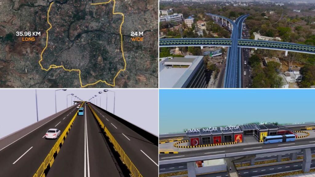
Concept Images of HCMTR corridor in Pune
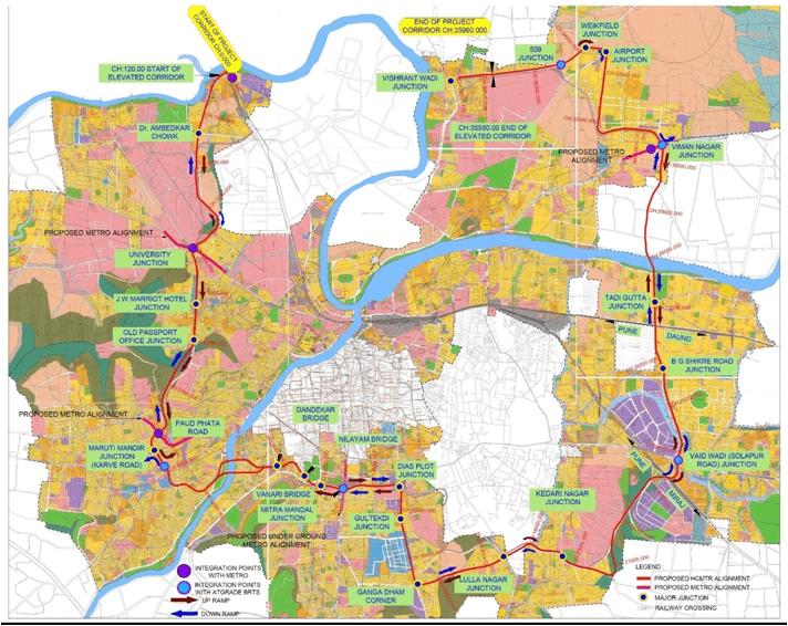
The Maharashtra state government has approved the Pune Municipal Corporation’s proposed High-Capacity Mass Transit Rapid (HCMTR) corridor, aiming to enhance transportation within Pune. Citizens can expect to see activities and updates in the coming month.
Project Details:
- Objective: Improve traffic flow across Pune
- Length: 35.96 kilometers
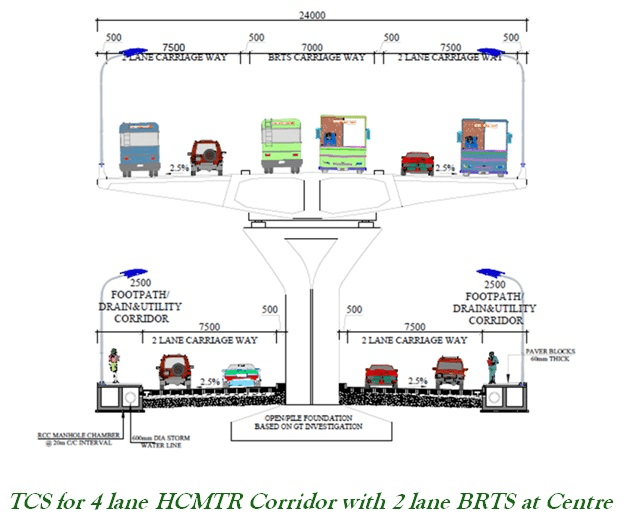
- Width: 24 meters
- Key Locations: Bopodi, Savitribai Phule Pune University, Senapati Bapat Road, Paud Phata, Karve Road, Dattawadi, Sarasbaug, Swargate, Nehru Road, Lullanagar, Wanowrie, Ramwadi, Vadgaon Sheri, Viman Nagar Chowk, and Vishrantwadi
The PMC unanimously endorsed the HCMTR project in a recent council meeting. After forwarding the proposal to the state government for approval in February 2022, it has now been sanctioned with certain conditions. Adjustments have been made in specific areas, such as from Laxminarayan Talkies Chowk to Market Yard Corner and Gangadham Chowk to Aaimata Mandir.
Public Information:
- Detailed Map: Available at PMC offices for public viewing throughout the month
- Official Announcement: Accessible on the state government’s official website
This new corridor is expected to significantly improve transportation speed and efficiency within Pune, benefiting residents and commuters alike.
Objectives and Project Benefits:
- Improve the Public Transportation System
- Improve Safety and Level of Service for Private Traffic, both Local and Through Traffic by increasing mobility
- Meet future travel demand and reduce traffic congestion on existing roads
- Facilitate continuous and uninterrupted traffic movements for through traffic
- Save travel time and reduce vehicle operating costs
- Reduce negative impact on the environment and social issues
- Reduce pollution levels
Proposed HCMTR Structure:
- 35.96 km elevated six-lane corridor passing over 34 junctions
- 6-lane elevated road with 2 dedicated lanes for BRTS with 26 stations
- 4 lanes for private vehicles (4 wheelers) with 17 up-ramps and 16 down-ramps
- Commonly known as the inner ring road
- Designed for a minimum speed of 50 kmph and an average speed of 25 kmph
- Four-layered multimodal transport hub at University Chowk, also accommodating the Hinjawadi-Shivajinagar Metro Line 3
- Heavier commercial vehicles traveling to and from the Market Yard can use this corridor without entering the city
A notification for objections and suggestions from citizens will be issued soon.

